Uses of maps for name studies
Maps, both historic and contemporary, are an invaluable aid to studying names: as sources for early spellings, as providers of geographical information, and as tools. It’s not surprising that they often features in books and articles on names, or that on the trips that are always a highlight of our SNSBI spring conferences members are often seen animatedly matching well-worn maps to landscapes.
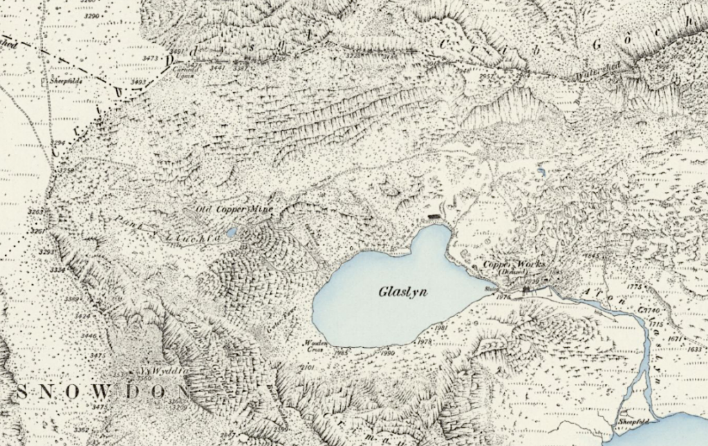
Maps are an important source of place-name spellings, not only because the places in question are named and located, but also because the maps and therefore the spellings they preserve are usually dated quite exactly. The wider geographical or topographical information provided by maps is also extremely useful as a context for understanding names. For instance, the shape of contours or the presence or absence of a watercourse might help to confirm or rule out a possible etymology, or more broadly to form a picture of the kind of place referred to by a recurrent place-name or place-name element.
As well as using existing maps in these ways, researchers often create distribution maps as vital tools for studying names, including family names. Many of our Family name stories show how crucial the evidence of distribution can be in understanding their histories, and everyone with interests in this field is especially indebted to Steve Archer for mapping family names as they appear in the 1881 Census.
Maps through the centuries
The oldest regularly cited map for the place-names of Britain and Ireland is the one embedded in Ptolemy’s Geography of about 150 AD, though of the manuscripts of the work that include maps none is earlier than the thirteenth century. Other early maps such as the eleventh-century Cotton world map (Mappa Mundi) or Matthew Paris’s thirteenth-century map of Britain are intriguing, but naturally selective in their coverage.
By the late sixteenth century, cartographic techniques improved, partly influenced by Flemish mapmakers, and mapping at county level came into vogue and remained so into the twentieth century. Christopher Saxton’s Atlas of the Counties of England and Wales (1579) and John Speed’s The Theatre of the Empire of Great Britaine (1611) are among early landmark publications. Starting about the same time, a still greater level of detail is offered by estate maps created for major landowners and showing, and often naming, individual fields, woodlands, buildings and other features.
Two major developments at national level also involved large-scale mapping and documentation. Land enclosures (which involved changes such as merger of smallholdings and enclosing of common land) are documented especially in Enclosure awards and maps of the late eighteenth and nineteenth centuries. The Tithe Survey, begun in 1836, produced detailed Tithe Maps, showing numbered fields which are described and often named in the accompanying Tithe Apportionment documents. Note that areas covered by enclosure maps often don’t have tithe maps, and areas covered by tithe maps often don’t have enclosure maps.
The Ordnance Survey (OS) gradually emerged and evolved in the decades around 1800, initially with military priorities but gradually becoming the national mapping agency that it remains today. The survey of Ireland at the scale of six inches to the mile (1824-46) pioneered procedures that were adopted, and adapted, for the whole of Britain and Ireland, including the use of ‘Name Books’ to record place-names, with authentication from local informants and descriptions of places. (In 1922 the mapping of Ireland passed from the OS of Britain to the OS of Ireland and the OS of Northern Ireland.) Almost all the original Name Books for Scotland and Ireland survive and are invaluable for names research, while for England only the historic counties of Cumberland, Westmorland, Northumberland, Durham and Hampshire (Isle of Wight) have surviving coverage. The remainder, and the whole of the Wales sequence, was destroyed in 1940 in a bombing raid on Southampton.
The chief modern products of the OS are countrywide maps of the Explorer series (scale of 1:25,000) and Landranger series (1:50,000). Historical maps of Prehistoric Britain and Roman Britain are often useful to names researchers.
Online sources of maps
Ordnance Survey (OS)
Ordnance Survey (OS) OpenData. Includes overview maps, local maps and specialised ones (geological, rivers etc.).
Bing Maps. Current OS maps at various scales, together with ‘Satellite’, ‘Bird’s Eye’ and ‘Streetside’ views.
MapServe. Advice on accessing OS maps.
National Library of Scotland NLS). Comprehensive sets of digitised OS maps of Scotland and other parts of Britain and Ireland, from first editions to the 1970s.
Streetmap. Current OS maps at various scales. Note copyright restriction: ‘This data may not be reproduced in any form without permission’.
Copyright
Note that for Ordnance Survey maps Crown Copyright applies for 50 years from the date of the map; for commercial maps copyright applies for 70 years. For guidance on copyright see this advice from the National Library of Scotland.
Other mapping
British Geological Survey (BGS). The BGS Geology viewer: an interactive app mapping bedrock and superficial geology.
British History Online. Carries a range of early OS maps and selected others.
Googlemaps. Includes various mapping options (including ‘terrain’, though without detailed contouring) as well as Satellite view and Street view.
Land Information System (LandIS). Hosts free and paid for resources on the soils of England and Wales. The Soilscapes viewer provides free access to a 1:250,000 scale simplified soils dataset covering England and Wales.
National Library of Scotland (NLS). In addition to digitised OS maps, NLS offers an indispensable collection of other digitised historic maps. It also houses the Lesmahagow place-names database.
Natural England. Regional agricultural land classification maps.
OpenStreetMap. ‘A map of the world, created by people like you and free to use under an open licence.’
UK Centre for Ecology and Hydrology. Land cover maps.
A Vision of Britain through Time. The website carries a wide range of historical maps: topographical (mainly small-scale Ordnance Survey or War Office), boundary maps and land use maps.
Hodskinson’s 1783 map of Suffolk.
Map of Essex 1777 by John Chapman & Peter André.
Online gazetteers
British Placename Mapper. This tool, produced by Robin Wilson, ‘lets you visualise British place names that match certain search terms on a map.’ Examples given are burgh, hampton and bach. Note that the mapping of recurrent place-name elements is based on modern spellings, and therefore can only an approximate starting-point as a guide to the original distribution of elements. See also this blog post for interesting examples.
Gazetteer of British Place-Names. Produced by the Association of British Counties, this aims to include ‘every settlement (above isolated houses and farmsteads) which has a distinct name and identity’ as well as natural features; each place is related to its historic county and can be viewed on a map.
GB1900 Gazetteer. This vast collection of transcribed names from OS Six Inch maps of England, Scotland and Wales (2nd edition, 1888-1914) is available in various formats for download from the Vision of Britain through Time website (the link given here) and also from the National Library of Scotland website.
Geonames. ‘The GeoNames geographical database covers all countries and contains over eleven million placenames that are available for download free of charge.’
OS Open Names. Part of OS OpenData, and ‘A comprehensive dataset of place names, road numbers and postcodes for Great Britain’.
Selected further reading
Archer, Steve (2003–15), British 19th Century Surname Atlas, version 1.20.
Harley, J. B. (1972), Maps for the Local Historian: A Guide to the British Sources.
Hindle, Brian Paul (1988), Maps for Local History.
Oliver, Richard (1993), Ordnance Survey Maps: A Concise Guide for Historians.
Wallis, H. M. (1994), Historians’ Guide to Early British Maps.
Text © Diana Whaley 2024